Glen Canyon National Recreation Area
National Recreation Area · AZ, UT
Park Closure · Chains Road and The Chains day-use area are temporarily closed
While there is no threat to public safety and the risk to the dam remains low, there was a discovery of several bore holes containing detonation cords along a restricted service road leading to Glen Canyon Dam. An Explosive Ordnance Disposal team assessed the site and determined the materials date back to the dam's original construction. The National Park Service, Bureau of Reclamation, and explosives experts have restricted access to the area while mitigation options are evaluated.
Park Closure · Launch Ramp Updates
Lake level changes will influence the functionality of all launch ramps. Find updated status of all launch ramps at the link.
More informationCaution · Lake Powell Recreational Water Advisory
Any time that you do recreational activities (swimming, water skiing, making sand castles, etc.) on the beaches or in the waters of Lake Powell you are strongly encouraged to follow basic hygiene practices. A number of conditions can cause potential water quality issues on Lake Powell, at Lees Ferry, and on Colorado River tributaries.
More informationCaution · Lees Ferry Campground Partial Closure
The upper loop of the Lees Ferry Campground is closed for renovations. Large equipment will be paving at the Lees Ferry campground. Do not enter construction area.
More informationLog in to be notified when a closure is lifted.
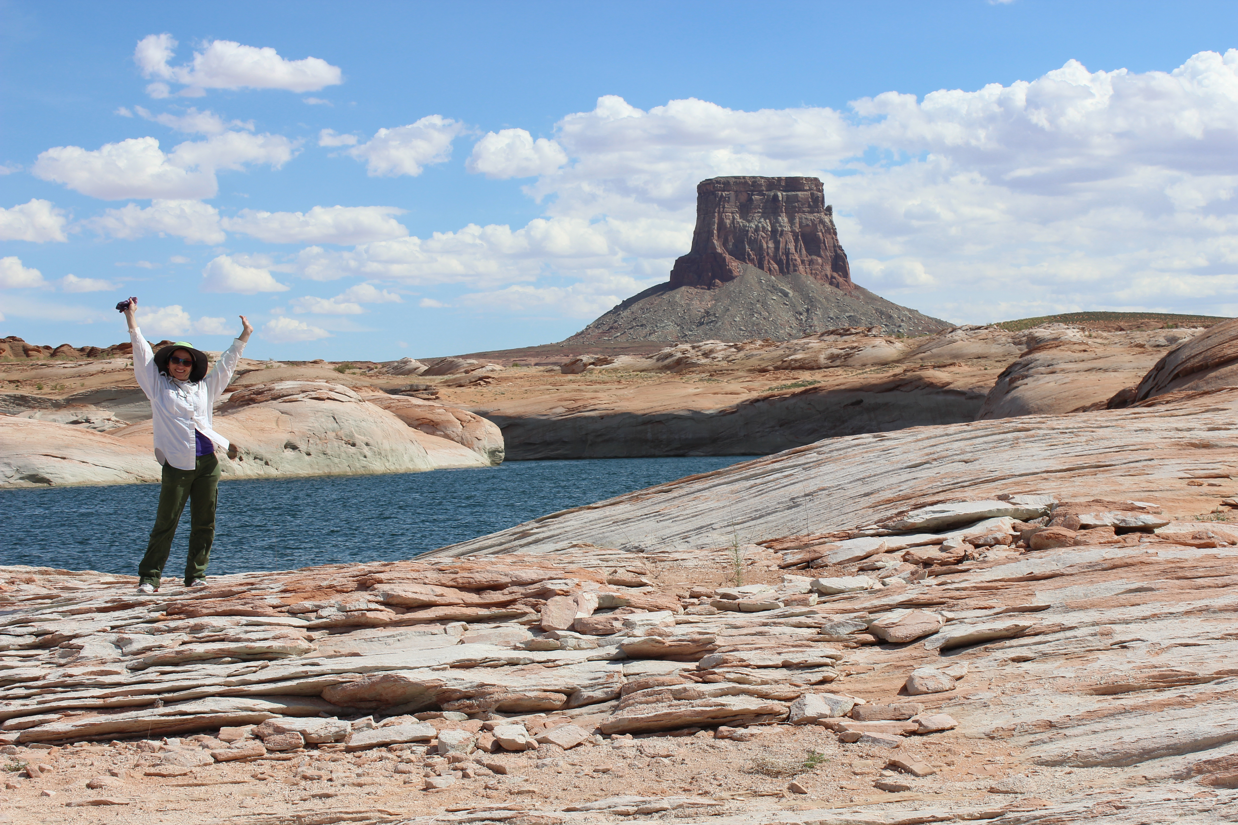
Encompassing over 1.25 million acres, Glen Canyon National Recreation Area offers unparalleled opportunities for water-based & backcountry recreation. The recreation area stretches for hundreds of miles from Lees Ferry in Arizona to the Orange Cliffs of southern Utah, encompassing scenic vistas, geologic wonders, and a vast panorama of human history.
- NPS site
- nps.gov/glca
- Location
- Glen Canyon National Recreation Area (36.936, -111.486)
Track your visit to Glen Canyon National Recreation Area
NP Tracker keeps a record of every National Park Service unit you visit — all 430-plus of them. Log visits with dates and photos, collect passport stamps, plan trips, and watch your map fill in. It's free.
Passport stamp locations
- Bullfrog Visitor Center
- Carl Hayden Visitor Center
- Escalante Interagency Visitor Center
- Glen Canyon Conservancy Flagship
- Navajo Bridge
- Navajo Bridge Interpretive Center
Hours
Glen Canyon Open Hourstoday: All Day
- Sun Nov 22All Day
- Mon Nov 23All Day
- Tue Nov 24All Day
- Wed Nov 25All Day
- Thu Nov 26All Day
- Fri Nov 27All Day
- Sat Nov 28All Day
Glen Canyon National Recreation Area is open 24 hours per day, year-round. If there is not a person staffing the entrance station, you may pay your entrance fee at the automated fee machine. Launch ramps are open all day, unless closed due to low water.
Hours are retrieved from the National Park Service and can change without notice — check the official site before you go.
When to go
Busiest in June, warmest in July
Busiest in June, quietest in January.
Each month is its median across 2021–2025: the middle year’s figure, so one unusual year doesn’t skew it. Recreation visitors only. Typical, not a forecast for your dates. Source: NPS Stats.
Warmest in July (98° / 73°), coolest in December (45° / 30°).
Average daily high and low, °F, and monthly precipitation, 1991–2020, measured at Page Muni AP, 4 km away, 1,314 m up. Typical, not a forecast for your dates. Source: NOAA climate normals.
Things to do
12
- Contemplate Your Place in the Landscape At The Big Map
The Glen Canyon and Surrounding Area Relief Map sits in a place of honor at the Powell Museum & Archives next to Glen Canyon Conservancy's Flagship office. Use it to help plan your Glen Canyon adventure, or pretend you are in space looking down at the landscape. Whoa.
1-120 Minutes · All year · Fee
- Day Trip or Backpack Hike to Coyote Gulch
Open year-round but most popular in Spring and Fall, Coyote Gulch is a tributary of the Escalante River with several entry points for day hiking or backpacking in the Escalante Canyons of Glen Canyon National Recreation Area and Grand Staircase National Monument. This is a wilderness area, prepare to pack out everything you bring in.
1-14 Days · All year · Reservation required
- Driving the Burr Trail
Drive the scenic Burr Trail from Glen Canyon's Bullfrog district, along the bottom of Capitol Reef, through Grand Staircase, to Boulder, UT. Distance: 67 miles (108 km) one-way Mix of paved and dirt roads, impassable when wet Four-wheel drive sometimes required. No RVs.
1-14 Days · All year · Fee
- Driving the Hole in the Rock Road
The Hole-in-the-Rock road is an historic pioneer trail turned path to adventure. This 62 mile (100 km) one-way section runs from Escalante, UT to the western edge of Lake Powell. This road is rough, impassable in inclement weather, and 4WD only for the last 7 miles. Along the way are quite a few trailheads for the Coyote Gulch and other Escalante River trails in Glen Canyon.
1-14 Days · All year
- Driving to Alstrom Point
Drive the semi-improved roads to Alstrom Point, in the southwest region of Glen Canyon National recreation Area along the border with Grand Staircase-Escalante National Monument near Big Water, UT. Distance: 46 miles round-trip, about 4 hours if you do not stop to look at the scenery Mix of paved and dirt roads, impassable when wet Four-wheel drive recommended for the final five miles and required at the last parts of the road. No RVs.
4-48 Hours · All year
- From Your Boat To The Bridge
There is one designated trail within the boundaries of Rainbow Bridge National Monument. It runs the length of the monument, from the boat dock on one side, to the border with the Navajo Nation on the other. We ask that you stay on this trail when you visit Rainbow Bridge for your safety and out of respect for the local Native American tribes that hold this place special to them.
2-8 Hours · All year
- Lake Powell Shoreline Primitive Camping
"Backcountry" Shoreline camping on Lake Powell can range from toughing out the desert winter from your kayak to "roughing it" in a multimillion dollar houseboat and any level of camping/glamping in between. Enjoy the beaches of Lake Powell the way that best suits you.
1-14 Days · All year
- Lonely Dell Ranch Historic Site
Hidden between the shade of trees near the muddy Paria River sits Lonely Dell Ranch. This historic site was once home to those who operated the river crossing at Lees Ferry. Life was challenging on the homestead, but the families who chose to live on this secluded outpost left behind a story of hard work and perseverance.
1-8 Hours · All year
Visitor centers
6
- Bullfrog Visitor Centerclosed todayDirections
- Carl Hayden Visitor Centertoday: 9:00AM - 4:00PMDirections
- Escalante Interagency Visitor Centerclosed todayDirections
- Glen Canyon Conservancy Flagshipclosed todayDirections
Campgrounds
11, 11 open today
- Antelope Point RV Park
open today · 104 reservable sites · from $70
ReserveDirections - Beehives Primitive Campground
open today · 21 first-come sites · from $14
ReserveDirections - Bullfrog RV & Campground
open today · 24 reservable, 75 first-come sites
Reserve
Self-guided tours
2
Historic River Tour at Lees Ferry1–3 hours · 12 stops
Throughout the 1800 and 1900s, Lees Ferry was backdrop to a mix of Westward expansion dreams ad failed schemes. Because of its strategic location along the Colorado River, unlikely groups overlapping on these shores. Walk the River Trail to glimpse the myriad people and purposes that left a mark on Lees Ferry. ..... 2 miles (3.2 km) round trip. Mixed terrain includes gravel, sandy, and rocky uneven surfaces. Nominal elevation change. Not a loop - return on the same path you took.
Lonely Dell Historic Ranch Tour45–60 minutes · 12 stops
Meet the cast of characters that toiled in the desert sun at this rustic outpost near the crossing of the Colorado River at Historic Lees Ferry. Walk through 100 years of history and learn how Lonely Dell Ranch acted as a hideout, a home, a career, a retreat, and now a link to the past. 1 mile (1.6 km) round trip Visit the Trailhead in the parking lot to start. Continue past the gate and look for waysides to follow the self-guided tour.
Entrance fees
5
- Private Vehicle — $30.00
Admits one single, private, non-commercial vehicle and all its passengers.
- Motorcycle — $25.00
Valid for 7 days. Admits up to 2 private, non-commercial motorcycles with up to 4 total passengers.
- Per Person — $15.00
Admits one individual when entering on foot or bicycle. Individuals 15 years of age and younger are admitted free.
- Education/Academic Groups — Free
Academic fee waivers must be submitted and returned before you visit Glen Canyon National Recreation Area.
- Annual Entrance - Park — $55.00
Annual pass is a card signed for and held by the owner. Allows unlimited entry for cardholder and everyone in that person's private vehicle to Glen Canyon National Recreation Area for 12 months from date of purchase. Does not cover vessel expanded amenity fee.