City of Rocks National Reserve
National Reserve · ID
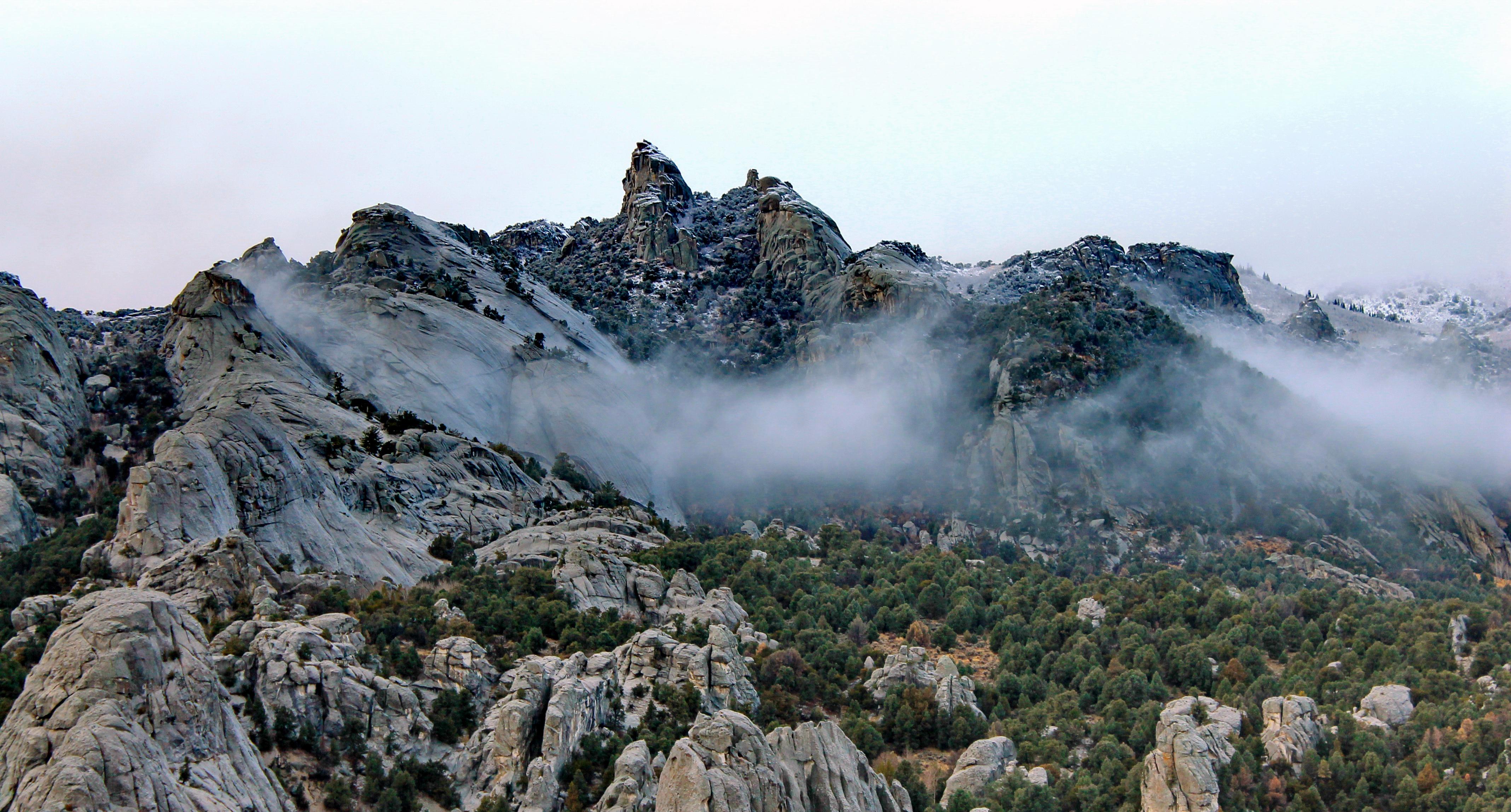
Described by California Trail emigrants as “a city of tall spires,” “steeple rocks,” and “the silent city,” this awe-inspiring landscape continues to captivate. Today, it beckons rock climbers, hikers, campers, hunters, and adventurers with its dramatic scenery, fascinating geology, and echoes of the Old West. The Silent City is ready for you to explore.
- NPS site
- nps.gov/ciro
- Location
- City Of Rocks National Reserve (42.070, -113.712)
Track your visit to City of Rocks National Reserve
NP Tracker keeps a record of every National Park Service unit you visit — all 430-plus of them. Log visits with dates and photos, collect passport stamps, plan trips, and watch your map fill in. It's free.
Passport stamp locations
- City of Rocks National Reserve, the California Trail
- City of Rocks Visitor Center
Hours
City of Rocks National Reservetoday: All Day
- Sun Nov 22All Day
- Mon Nov 23All Day
- Tue Nov 24All Day
- Wed Nov 25All Day
- Thu Nov 26All Day
- Fri Nov 27All Day
- Sat Nov 28All Day
The National Reserve is open 365 days a year, 7 days a week, 24hrs/day. Many roads are not maintained during the winter and may become impassable from late November through May. For current conditions visitors are encouraged to check with the Visitor Center or watch for alerts on our website and social media.
Hours are retrieved from the National Park Service and can change without notice — check the official site before you go.
When to go
Busiest in June, warmest in July
Busiest in June, quietest in February.
Each month is its median across 2021–2025: the middle year’s figure, so one unusual year doesn’t skew it. Recreation visitors only. Typical, not a forecast for your dates. Source: NPS Stats.
Warmest in July (86° / 59°), coolest in January (35° / 16°).
Average daily high and low, °F, and monthly precipitation, 1991–2020, measured at Rosette, 37 km away, 1,733 m up. Typical, not a forecast for your dates. Source: NOAA climate normals.
Things to do
27
- Archeology of Castle Rocks Guided Hike
During this 1.10 mile ranger guided hike you will get to explore the archaeology of Castle Rocks State Park. The hike is easy to moderate with some elevation change. You will explore Native American pictographs, petroglyphs, and a rock shelter that was occupied for hundreds of years. Through this hike you will get a sense of what the landscape and everyday life was like thousands of years ago.
1-2 Hours · Reservation required
- Archery Course at Castle Rocks
This course at Castle Rocks State Park has more than 20 stations. Shot distance ranges from 20 yards to 60 yards depending on target size.
Fee
- Backcountry Camping in Indian Grove
Backcountry camping is available in the designated Indian Grove area within City of Rocks National Reserve. Permits are required for backcountry camping and must be approved prior to your arrival.
1-14 Days · Reservation required
- Become a City of Rocks Junior Ranger
Junior Rangers "Explore, Learn, and Protect" their national parks. Pick up a free booklet from the Visitor Center to learn about geology, nature, and history in City of Rocks National Reserve. Complete fun activities like scavenger hunts, fill-in-the-blanks, and word searches. Once you've finished the recommended number of activities, turn in the booklet, take the park oath, and earn your Junior Ranger Badge!
- Bike the Tea Kettle Trail
Tea Kettle Trail is a great mountain biking trail that runs between Bread Loaves and Elephant Rock. The trailhead can be accessed from the Bread Loaves group camping parking lot or the parking area next to Elephant Rock. From one end to the other, the trail is 3 miles. Mountain bikers can connect with other trails or ride on the road to create loops and longer rides.
30-60 Minutes
- Birding in the City of Rocks Checklist Area
Few places in Idaho other than the City of Rocks Checklist Area offer such a high concentration of bird species, making this a top birding destination. The Checklist Area includes the National Reserve, Castle Rocks State Park, and the Almo and Upper Raft River valleys. These are some of the best locations in the Idaho for observing Pinyon Jay, Virginia's Warbler, Gray Flycatcher, Juniper Titmouse, Bushtit, Greater Sage-Grouse, Black-throated Gray Warbler, and Plumbeous Vireo.
- Camping
Camping in City of Rocks, or nearby Smoky Mountain Campground is a great way to enjoy being out in nature. Relax beneath the cool shade of aspen, juniper, mountain mahogany, or pine. Spend the night surrounded by impressive granite formations and starry skies.
1-14 Days · Fee
- Disc Golf at Castle Rocks
With the dramatic Castle Rocks landscape in the backdrop, this small three-hole disc golf course is fun for all ages and abilities. The lush grassy area of Castle Rocks Ranch has large shady trees that provide a welcome reprieve from summer heat. There are bathrooms, and picnic facilities in this area with more a short distance up the road at Stines Creek.
30-60 Minutes
Visitor centers
1
- City of Rocks Visitor Centerclosed todayDirections
Campgrounds
2, 2 open today
- City of Rocks Campground
open today · 67 reservable, 6 first-come sites · from $14
ReserveDirections - Smoky Mountain Campground
open today · 38 reservable, 38 first-come sites · from $3
ReserveDirections
Self-guided tours
3
Back Yard Boulders in Castle Rocks State Park1–2 hours · 7 stops
Castle Rock is the centerpiece of this 2-mile loop trail. It features impressive rocks as well as archaeological sites such as the Shock and Awe Shelter and pictographs. In spring hikers may encounter many species of wildflowers and experience the arrival of migratory birds. In autumn, hikers are treated to the colorful foliage of aspen, chokecherry, and willow. Signs and numbered markers are strategically located to help you find the route.
Creekside Towers Trail1–2 hours · 6 stops
Creekside Towers is an out-and-back 1.2-mile trail, nearby trails (such as Stairways and South Fork Circle Creek trails) could make for a longer and more adventurous loop. The trail’s gentle grade of 122 feet relative elevation is suitable for families with children or anyone looking for an easier hike in the Reserve. In spring and early summer enjoy the running creek and small cascading waterfall. Outstanding scenery, sculpted granite pinnacles, and a diversity of plants and animals await you.
Geological Interpretive Trail1–2 hours · 15 stops
A self-guided journey to discovering the geology at City of Rocks National Reserve. The 1 mile Geological Interpretive Trail is the perfect short hike to: - see fascinating geological formations up close - examine the difference between the Green Creek Complex and Almo Pluton - learn about the geologic history of this landscape Check out Intro 1, 2, and 3 on your way to the first station.
Entrance fees
No entrance fee.